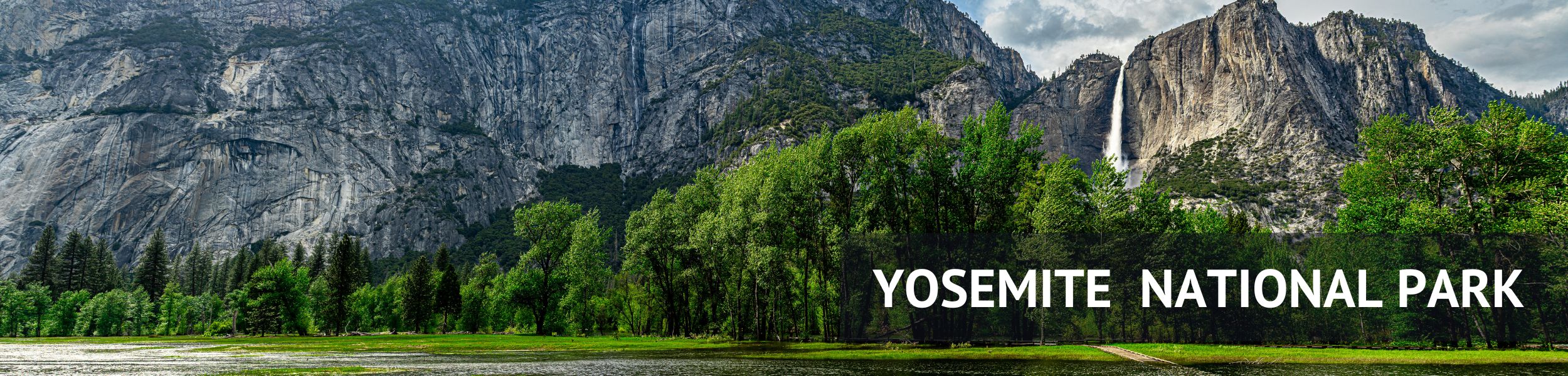
Saturday – May 27th, 2023
Today was to be a day that would tick ZERO items off our bucket list. The road closures that had caused so many issues on the way in would now REALLY bite as we needed to cross the Siera Nevada Mountains as we headed for Vegas. The current closures meant there was almost no way to do this and a 350-mile detour was on the cards!
However, despite our reluctance and annoyance at this detour, this became one of the most enjoyable and fulfilling drives we have ever done. We saw some incredible sights, found some amazing locations and even discovered a whole new part of California we had never visited before that we absolutely have to get back to.
Crossing the Sierra Nevada

There are 4 mountain Passes that cross through the Sierra Nevada Mountain Range. These link the coastal west side of the mountains to the eastern Dessert side. To get to Vegas we either had to cross the mountains, or go around them. All 4 Passes close in the winter, and open again once the Snow has been plowed normally in early May, and they tend to open from North to south based on their elevation. Carson Pass (88) First, the Ebbets (4), then Sonora (108), and Finally Tioga (120).
The round trip is nearly 400 miles and largely on boring freeways, with two options the southern route through the Sacramento and San Joaquin Valleys past Bakersfield and into the Mojave desert. Or head north and loop around near Lake Tahoe. Both are pretty unappealing options. However, as the months ticked by and the Snow continued to fall in record amounts the chances of the passes opening looked grim, infact at the worst of it even low-lying roads were shut and the whole area was one to pretty much avoid.
With just a few weeks to go the most southern pass, Carson Pass, Highway 88 opened up, but this only offered a very small saving in total distance and the relatively short hop of 136 miles through the Mountains would instead be well over 300, then the Big Pine Flat road closed adding even further mileage onto the route. And we still had a hearty 200-250 mile to Vegas to add onto the journey once we had negotiated the mountains!
Overall it was a choice between a lot of very poor choices. We came very close to canceling the Yosemite portion of the trip, however, it really is rare to see the Rivers and Waterfalls at such a high rate of flow so really glad we didn’t.
Highway – 88 Carson Pass
In the end, we opted for the Carson Pass Route. The fastest option would have been heading south and then straight for Vegas, but this would mean seeing nothing of interest on the route. By heading north we could make this a real road trip and include quite a few stops along the way. It would require an overnight, however, but that was the original plan anyway as we wanted to spend a night in Death Valley. Instead, we moved the Overnight a bit closer to try and break the journey up a little.
We woke fairly early in the morning and pulled out our phones to finalize the day’s plans…No internet…hmm. Ok, let’s make a coffee while we wait to see if the Wifi comes back…No Electricity…hmmm.
To cut a long story short, after heading to reception and only finding Chaos. we made the decision you get the hell out of dodge. There was no answer as to why the power was out, nor when it might come back, and as we were planning an early dart regardless, we just got going. We had lots of supplies so just hit the road.
The first section of the trip was heading north along the western edge of the mountains’ foothills. We didn’t have a lot of hope for this part of the journey, but it was actually really scenic and show a side of California we had not seen before. It was rural but was largely wilderness r ranchland not the sprawling flatlands of the rural valleys but picturesque rolling hills and fields.
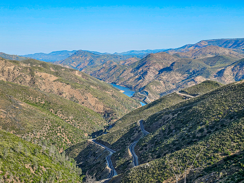
This was around 115 miles of driving and 2+ hours. When we got to Jackson, we then finally headed east and up through the mountains along Carson Pass. Make sure we filled the tank before heading into the wilderness.
Tioga Pass and Sonora Pass get all the headlines as the most picturesque Mountian Passes and we were a bit underwhelmed at the thought of Carson, but in the end, it was a stunning road that wound high up, over 9,000ft into the heart of the Sierra Nevada.
Down in the Valley, it was 90-100°f and in Yosemite itself the daytime temps were peaking at 85°f+ it really was hard to understand why there was so much of an issue with snow. It wasn’t until the Pass started to reach above 7,000ft that it started to become clear. The rolling hills gave way to thick pine forests, which in turn started turning whiter and whiter as the elevation rose.
We drove through mountainous snowdrifts meters thick that had been plowed out of the way and found frozen lakes and valleys filled with snow and ice. It was amazing to see having been sweltering in the valleys and then suddenly to be driving through the snowcapped peaks. The temperature was still a balmy 75°f and the sun shining so why this snow was not melting was a mystery to us but it was only slowly seeping away and suddenly we could see why the high mountain passes and trails were still closed.
After 100 or so miles of crossing the mountains, we descended down into the vast Mojave Dessert Plane. Here we began the southward leg back doe the eastern flank of the range.
Mono Lake

We almost didn’t stop on the first part of the journey as we had such a long way to go we at least wanted to tick a good portion off the list and then take our time nearer to the overnight stop. This meant the first place we visited was the otherworldly location of Mono Lake.
This inland lake is an example of the many Salt Lakes in this part of the country only this one is not dried up. Its highly alkaline salty waters teem with a unique ecosystem as migratory birds thrive on Brine Shrimp and Alkalai Flies. The waters shimmer a unique green, while strange geological formations, called Tufa, ride from its iridescent waters. This can lead to some really interesting and almost abstract photo opportunities so was always worth a stop.
Unfortunately, the conditions meant the water was a little too wavey for our photos to come out too well, and the sun was really beating down, The snowy mountains provided a really nice backdrop and it was great to get out of the car for a bit after several hours motoring along.


Inyo National Forest
Back in the car after the short detour down to the Tufa on a dirt track and we were heading south. The 395 runs almost the entire length of the country from the Canadian Border right down to the I15 just north of Los Angeles and it was this final portion we were motoring down right now.
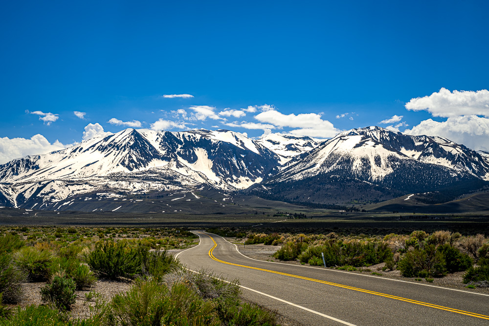
To our left the huge expanse of the Mojave Desert and the various mountains and small ranges that pockmark the landscape and to our right the majestic Sierra Nevada Mountian range and the Inyo National Forest. The views along this stretch of the road were simply breathtaking. The Jagged snowcapped mountains rise abruptly up from the Flat Valley floor! It was one of the most perfect Mountain Vistas we could imagine.
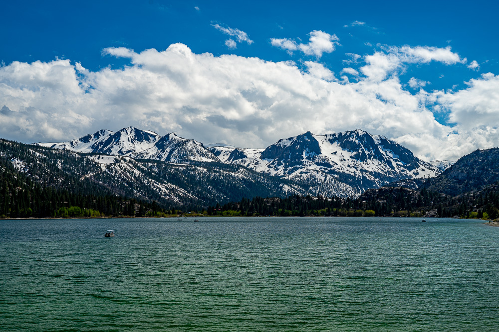
The first incursion into the Inyo National Forest was at June Lake. We had planned to head up to Little Lakes Trail and hike out to some of the most beautiful lakes in the world but, unsurprisingly, the road to the Trail was closed! So instead we settled for some of the more accessible lakes and vistas in the area.
If June Lake was one of the less pretty lakes, we can scarcely imagine what the better lakes looked like. This one was a real peach. Green Glaciers Melt water contrasts perfectly with the stark Black Snowcaps and the stunning blue skies. We didn’t hang around as we knew the later lakes were even better.
The next stop was Mammoth Mountain. A mountain and a Town with the same name. This was more of a detour as we needed to head off the 395 and up into the mountains. The Scenic Route in was very pretty and the higher we got the more the Snow accumulated. The radio changed over to a local station that repeatedly talked about the record snows and how they had impacted life in the area over the winter.
As we reached the town of Mammoth we finally found the Memorial Day Crowds! And there were huge queues into the Town. The pretty little Main Street of Mammoth looks amazing, like a quant Alpine village with endless coffee shops, restaurants, and Craft Breweries. We did not have time to stop here but would love to come and stay over a few nights.
Heading out of town we found the road we wanted, Lake Mary Rd, was closed but we pushed on up hoping the closure was after the Twin Lakes Vista point we were headed to and luckily it was.
Twin Lakes was just breaking through from its Icey Winter state and the sharp mountains rose majestically out of the Icey waters. At the Freshly Plowed Car Park, we considered getting a Bus but thought better of it after seeing the BusStop (see Photo). We spent a while here just taking a break from the car and taking in the scene. This was another location where we were in Shorts and T-Shirts and were still warm yet copious amounts of Snow lay on the ground!


We also got to witness the foolishness of man here. A teenage kid decided to jump onto an Ice Island was a good idea, unfortunately, this island insanely gave way, plunging him into an Icey Lesson. Our laughter erupted, only after his family had pulled him to safety! He was forced to hike back to the car, soggy and humiliated, but hopefully wiser.
The Final Stop on this Whirlwind Inyo Tour was Convict Lake. Another Short Detour from the 395 and stunningly beautiful. Seemingly minutes down the road and the conditions couldn’t have been more different. Warn and sunny and filled with folks out on the lake boating and trying their hand at bagging some of the local trout.
The Mountain vistas over the lake here were even prettier than the others and we took a short hike along the bank of the lake. Basking in the glorious spring sunshine as the rocky spires towered over the sparkling waters.


Bishop, California
From here we made a final dash for the overnight spot of Bishop, only briefly stopping for a quick stop at the Stunning Mount Tom Overlook, what a pretty mountain.


We chose Bishop almost exclusively as it was the only built-up settlement, around halfway along the route. Lee-Vining would have been too early and Mammoth was just too expensive so we had booked a cheap Motel in the town with almost zero knowledge of the place.
It turns out it was a bad choice simply because we managed to time it perfectly for their annual Muel Days festival. This meant the town was rammed and our fairly cheap motel was actually pretty expensive for the low level of accommodation we received.
We checked into the Motel and then headed out to track down a nice BBQ restaurant we had spotted on Google. Holy Soke Texas Style BBQ. This was excellent, and the Ris and Pulled Pork were simply amazing. This is your classic Texas Style Joint and we gorged on huge slabs of meat covered in their selection of BBQ Sauces. You know it’s a good pace when the queue is out the door, the offer rolls of Kitchen paper on the tables, and some of the menu items have already been sold, meaning they cook fresh and when it’s gone it’s gone. We were a little disappointed we missed the Brisket, but the St Louis Ribs were Stunning!


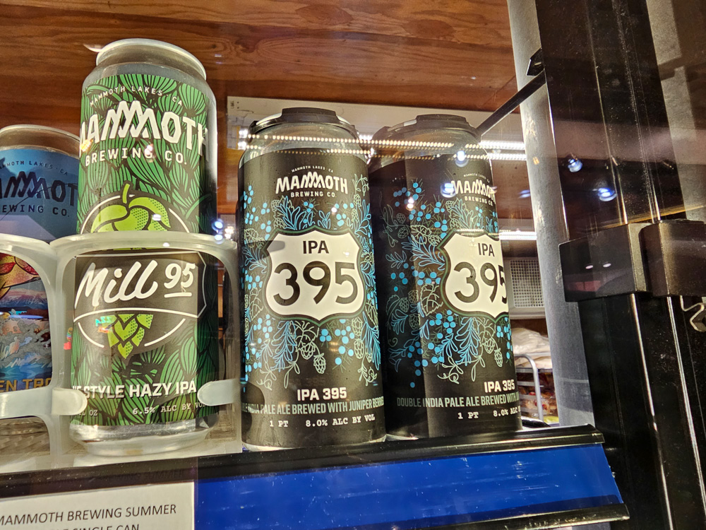
After this, we headed back to the Motel, after a little look around the town, and actually watched a little TV to wind down, something we hadn’t done in quite a while! Along with a few drinks from the excellent Mammoth Brewing Company which felt very fitting! We have to admit, we were pretty exhausted just writing about this day, let alone living it!
Walking Total – 8314 Steps – 4.2 Miles
This was first and foremost a driving day, and the low step count shows how much time we spent parked on our butts!
